







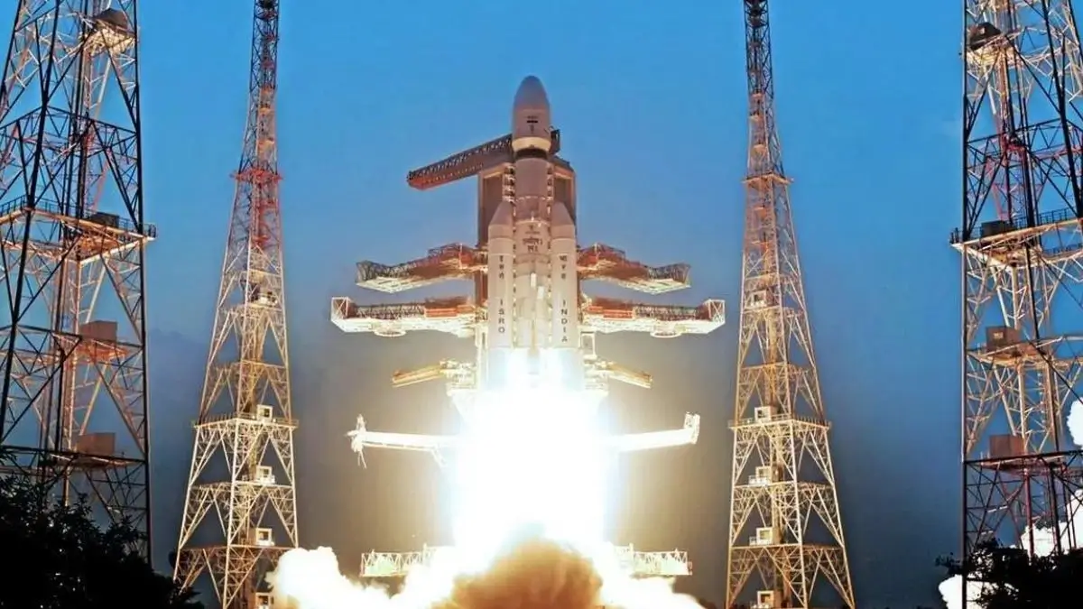
GSLV-F17 EOS-05 mission is an important ISRO space mission involving the launch of the EOS-05 Earth Observation Satellite. Learn about GSLV Mk II, GISAT-1A, satellite imaging, applications and key exam facts.
ISRO Prepares for GSLV-F17 Mission with EOS-05
The Indian Space Research Organisation (ISRO) is preparing for the GSLV-F17 mission, which will carry the EOS-05 Earth Observation Satellite into space. The mission is significant for India’s space programme because it is aimed at strengthening the country’s Earth-observation capabilities and providing valuable satellite-based information for strategic and civilian applications. EOS-05 is also known as GISAT-1A and is part of India’s efforts to develop advanced geospatial imaging capabilities.
EOS-05: An Advanced Earth Observation Satellite
EOS-05 is designed to provide frequent observations of large geographical areas. Earth-observation satellites are important because they collect information about land, water, vegetation, weather-related conditions and changes taking place on the Earth’s surface. Such satellite data can support disaster management, environmental monitoring, agriculture, infrastructure planning and national security.
The GISAT series is particularly important because its imaging concept is intended to provide rapid observations of the Indian landmass. The satellite is designed to use multispectral and hyperspectral imaging technologies, allowing different characteristics of the Earth’s surface to be studied through multiple spectral bands.
GSLV-F17 and the GSLV Mk II Launch Vehicle
The EOS-05 satellite will be launched using GSLV-F17, a mission based on ISRO’s Geosynchronous Satellite Launch Vehicle Mk II. The GSLV Mk II is a three-stage launch vehicle equipped with four liquid strap-on motors. Its third stage uses an indigenous cryogenic engine, a technology that has been an important part of India’s progress in launch-vehicle development.
For competitive examinations, candidates should remember the distinction between PSLV and GSLV. PSLV is widely associated with polar and sun-synchronous missions, whereas GSLV Mk II was developed primarily to place heavier satellites into geosynchronous transfer orbits.
Importance of Geostationary Earth Observation
The EOS-05 mission is particularly noteworthy because Earth observation from a geostationary or geosynchronous operational configuration can provide repeated views of a broad region. This capability is useful when rapid changes need to be monitored rather than relying only on occasional observations from satellites that pass over a location at particular intervals.
Such technology can strengthen India’s ability to monitor natural disasters, agricultural conditions, environmental changes and other large-scale developments. Rapid satellite imagery can also assist government agencies in planning and responding to emergencies.
Applications in Disaster Management
One of the major applications of advanced Earth-observation satellites is disaster management. Satellite imagery can help authorities assess the extent of floods, cyclones, landslides, forest fires and other natural hazards. Frequent observations can provide decision-makers with updated information during rapidly developing situations.
For government-exam aspirants, this aspect connects the mission with topics such as disaster management, remote sensing, climate monitoring, environmental governance and the use of science and technology in public administration.
Multispectral and Hyperspectral Imaging
EOS-05 is important from a technological perspective because of its advanced imaging capabilities. Multispectral imaging captures information in selected portions of the electromagnetic spectrum, while hyperspectral imaging uses a much larger number of narrow spectral bands.
These technologies can help distinguish different materials and surface conditions that may not be easily identified through ordinary visible-light imagery. Their applications can extend to agriculture, mineral exploration, environmental studies, water-resource management and strategic monitoring.
Strategic Significance for India
Earth-observation satellites have applications beyond scientific research. Satellite-derived information can contribute to infrastructure development, resource management, border monitoring, disaster response and strategic planning. The availability of indigenous satellite capabilities reduces dependence on external sources of high-value geospatial information.
The EOS-05 mission therefore represents both a scientific and strategic investment in India’s space-based observation infrastructure.
EOS-05 and the Earlier GISAT Programme
EOS-05 is connected with India’s earlier GISAT effort. The first GISAT mission, associated with EOS-03, was lost after the GSLV-F10 mission encountered a problem during its flight in August 2021. The new EOS-05/GISAT-1A represents an important continuation of the programme and the effort to achieve the intended geostationary Earth-imaging capability.
The experience from earlier missions is also valuable for ISRO because complex launch programmes require continuous improvements in vehicle reliability, satellite design, mission planning and ground-support systems.
Why the Mission Matters for Competitive Examinations
The GSLV-F17 and EOS-05 mission can be important for UPSC, State PCS, SSC, banking, defence, railways and other government examinations because it combines several frequently tested areas: ISRO, satellite technology, launch vehicles, Earth observation, remote sensing, geostationary orbits and India’s space programme.
Candidates should remember the mission number, launch vehicle, satellite name, satellite’s alternative designation and its broad purpose. Questions may also test the difference between GSLV and PSLV or ask about the significance of cryogenic propulsion.
India’s Growing Earth-Observation Capabilities
India has progressively expanded its satellite-based Earth-observation programme through missions designed for cartography, agriculture, weather observation, environmental monitoring and strategic applications. The EOS series forms an important component of this broader effort.
The continued development of Earth-observation satellites demonstrates how space technology is increasingly integrated with governance and economic development. Satellite data can support evidence-based decision-making and improve the government’s ability to monitor large and difficult-to-access areas.
A Major Science and Technology Development
The GSLV-F17 mission highlights India’s growing capability to design, build and launch sophisticated satellites using domestic technologies. It also demonstrates the practical importance of space science for everyday governance rather than limiting its benefits to astronomy and scientific research.
For aspirants, the mission should therefore be studied as a science-and-technology current-affairs topic as well as an example of India’s strategic and developmental use of space technology.

Why This News is Important
Importance for India’s Space Programme
The GSLV-F17 mission is important because it advances India’s capability to place sophisticated Earth-observation satellites into suitable orbits. The mission demonstrates the continued development of India’s indigenous launch-vehicle and satellite technologies.
Importance for Disaster Management
Rapid satellite observation can provide government agencies with valuable information during floods, cyclones, landslides, forest fires and other disasters. Timely imagery can support damage assessment, rescue planning and resource allocation.
Importance for Agriculture and Environment
Earth-observation data can assist in monitoring crops, vegetation, water resources and environmental changes. Such information can contribute to agricultural planning and sustainable management of natural resources.
Importance for Strategic Applications
High-quality geospatial information also has strategic importance. Indigenous Earth-observation capabilities can support national planning, infrastructure development and security-related applications while reducing dependence on foreign satellite data.
Importance for Government Examinations
The mission covers several recurring examination themes, including ISRO, GSLV, cryogenic technology, Earth-observation satellites, remote sensing, geostationary orbits and India’s space programme. Candidates preparing for UPSC, State PCS, defence, SSC, banking and railway examinations should therefore add the mission to their science-and-technology current-affairs notes.
Historical Context: Background of India’s Earth-Observation Programme
Beginning of India’s Remote-Sensing Efforts
India’s space programme has historically placed strong emphasis on the practical use of satellites. Remote sensing became an important component of the national space programme because satellite observations could help monitor agriculture, forests, water resources and land-use patterns across the country.
Development of the IRS Series
The Indian Remote Sensing (IRS) satellite programme became an important foundation for India’s Earth-observation capabilities. Over time, ISRO developed satellites with increasingly sophisticated sensors and improved spatial, spectral and temporal resolution.
Evolution of the EOS Series
The Earth Observation Satellite series represents the continuation and modernization of India’s remote-sensing efforts. These missions cover different applications, including cartography, environmental monitoring, weather-related observations and strategic requirements.
The 2021 GISAT-1/EOS-03 Setback
An earlier GISAT mission, carried by GSLV-F10 in August 2021, did not achieve its intended mission because of an anomaly involving the cryogenic upper stage. The failure resulted in the loss of the EOS-03 satellite.
The subsequent EOS-05/GISAT-1A mission is therefore significant as a renewed effort to establish the intended advanced geostationary Earth-imaging capability.
Progress of GSLV Mk II
The GSLV programme has played a major role in India’s development of heavier launch capabilities. The successful development and operational use of indigenous cryogenic propulsion represented a major technological achievement for ISRO and strengthened India’s ability to launch heavier spacecraft.
Key Takeaways from GSLV-F17 and EOS-05 Mission
| S. No. | Key Takeaway |
|---|---|
| 1 | Mission: GSLV-F17 is the launch mission associated with the EOS-05 Earth Observation Satellite, also known as GISAT-1A. |
| 2 | Launch Vehicle: The mission uses the GSLV Mk II, ISRO’s three-stage launch vehicle with a cryogenic upper stage. |
| 3 | Satellite Purpose: EOS-05 is designed to strengthen India’s Earth-observation and geospatial imaging capabilities. |
| 4 | Applications: Satellite data can support disaster management, agriculture, environmental monitoring, infrastructure planning and strategic applications. |
| 5 | Exam Relevance: The mission is important for questions on ISRO, GSLV, Earth-observation satellites, remote sensing, cryogenic propulsion and geostationary satellite technology. |
Frequently Asked Questions (FAQs)
1. What is the GSLV-F17 mission?
GSLV-F17 is a mission of the Indian Space Research Organisation (ISRO) involving the launch of the EOS-05 Earth Observation Satellite, also referred to as GISAT-1A.
2. Which organisation is responsible for the GSLV-F17 mission?
The mission is being undertaken by the Indian Space Research Organisation (ISRO), India’s national space agency.
3. Which launch vehicle will be used for EOS-05?
EOS-05 is planned to be launched using the Geosynchronous Satellite Launch Vehicle (GSLV) Mk II.
4. What is the primary purpose of EOS-05?
EOS-05 is an Earth-observation satellite intended to provide advanced imaging and geospatial information for applications such as disaster management, agriculture, environmental monitoring and strategic planning.
5. What is another name associated with EOS-05?
EOS-05 is also known as GISAT-1A, forming part of India’s GISAT Earth-imaging programme.
6. What is special about the GSLV Mk II?
The GSLV Mk II is a three-stage launch vehicle featuring four liquid strap-on motors and an indigenous cryogenic upper stage.
7. What is remote sensing?
Remote sensing is the process of collecting information about the Earth’s surface without making direct physical contact with the objects or areas being observed. Satellites are an important platform for remote sensing.
8. What are multispectral and hyperspectral imaging?
Multispectral imaging collects information in several selected spectral bands, while hyperspectral imaging records information across many narrow and contiguous spectral bands. These technologies can help identify and analyse different characteristics of Earth’s surface.
9. How can EOS-05 help disaster management?
Earth-observation imagery can help authorities monitor and assess events such as floods, cyclones, landslides and forest fires. Frequent observations can support damage assessment and emergency planning.
10. Why is the GSLV-F17 mission important for government exams?
The mission connects several important science-and-technology topics, including ISRO, GSLV, cryogenic propulsion, Earth-observation satellites, remote sensing, satellite imaging and geostationary satellite technology. These areas are relevant to UPSC, State PCS, SSC, defence, railway and other competitive examinations.
Some Important Current Affairs Links