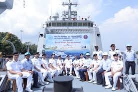
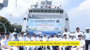
Indian Navy Commissions New Deep-Water Survey Vessel: Enhancing Maritime Capabilities
The Indian Navy has taken a significant step towards bolstering its maritime capabilities by commissioning a new deep-water survey vessel named INS Nirdeshak. This advanced vessel, designed for conducting hydrographic surveys in deep waters, was commissioned at the naval base in Visakhapatnam. With cutting-edge technology and advanced equipment, INS Nirdeshak will play a vital role in maritime security and navigation safety in the Indian Ocean Region.
Importance of Hydrographic Surveys
Hydrographic surveys are crucial for understanding underwater topography, which supports safe navigation, maritime operations, and resource exploration. The data gathered from these surveys is instrumental in charting coastal areas, mapping seabed resources, and aiding in disaster management. With increasing maritime traffic and geopolitical complexities in the region, the commissioning of INS Nirdeshak underscores the Indian Navy’s commitment to maintaining maritime safety and enhancing its operational readiness.
Advanced Features of INS Nirdeshak
INS Nirdeshak is equipped with state-of-the-art technology, including multi-beam echo sounders and advanced sonar systems, enabling it to perform precise underwater surveys. The vessel is also capable of conducting deep-sea exploration and research, which is essential for understanding marine ecosystems and ensuring environmental sustainability. The commissioning of this vessel marks a significant advancement in the Indian Navy’s hydrographic capabilities, allowing for more accurate data collection and analysis.
Strengthening India’s Maritime Security
The commissioning of INS Nirdeshak is part of the Indian Navy’s broader strategy to strengthen maritime security in the Indian Ocean Region. As maritime threats evolve, enhancing the Navy’s capabilities is essential for safeguarding India’s interests at sea. This vessel will support various operations, including maritime domain awareness, navigation safety, and resource management, contributing to the nation’s overall security framework.
Collaborative Efforts and Future Prospects
The Indian Navy’s initiative to enhance its survey capabilities also involves collaborations with various national and international maritime organizations. Such partnerships are essential for knowledge sharing and technology transfer, enabling the Navy to adopt best practices and innovative solutions in hydrography. With the commissioning of INS Nirdeshak, the Indian Navy is poised to take on a more proactive role in regional maritime affairs.

Why This News is Important
Enhancing Maritime Operations
The commissioning of INS Nirdeshak significantly enhances the Indian Navy’s ability to conduct hydrographic surveys, crucial for safe navigation and maritime operations. Accurate hydrographic data is essential for various maritime activities, including shipping, fishing, and naval exercises.
Addressing Security Challenges
With growing geopolitical tensions in the Indian Ocean Region, having advanced survey capabilities allows the Indian Navy to respond effectively to emerging threats. INS Nirdeshak will play a pivotal role in ensuring maritime security and sovereignty.
Supporting Environmental Sustainability
The vessel’s advanced technology aids in understanding marine ecosystems, facilitating sustainable resource management and environmental conservation. This is crucial for balancing development with ecological preservation.
Fostering Regional Cooperation
INS Nirdeshak’s commissioning reflects India’s commitment to fostering regional cooperation in maritime security. By collaborating with other nations and organizations, the Indian Navy can enhance collective maritime capabilities.
Long-Term Strategic Goals
The addition of INS Nirdeshak aligns with the Indian Navy’s long-term strategic goals of becoming a dominant maritime force in the region. This vessel will significantly contribute to maintaining India’s maritime interests and enhancing its global standing.
Historical Context
Background of the Indian Navy’s Hydrographic Capabilities
The Indian Navy has a long-standing history of undertaking hydrographic surveys since its inception. Hydrography is vital for naval operations, enabling safe navigation and supporting various maritime activities. Over the years, the Navy has expanded its capabilities through the acquisition of modern survey vessels and advanced technologies.
Evolution of Maritime Security
The evolution of maritime security in the Indian Ocean has been shaped by various factors, including increased shipping traffic, piracy threats, and geopolitical tensions. The Indian Navy has proactively adapted its strategies and capabilities to address these challenges, underscoring the need for advanced survey and reconnaissance vessels.
The Role of INS Nirdeshak in Historical Context
INS Nirdeshak represents a significant leap in the Navy’s hydrographic capabilities, continuing the tradition of enhancing maritime safety and operational readiness. As regional dynamics change, the vessel will play a critical role in the Navy’s mission to secure India’s maritime interests.
Key Takeaways from Indian Navy Commissions New Deep-Water Survey Vessel
| Serial No. | Key Takeaway |
|---|---|
| 1 | INS Nirdeshak is a new deep-water survey vessel commissioned by the Indian Navy. |
| 2 | The vessel enhances India’s hydrographic survey capabilities for safe navigation. |
| 3 | Equipped with advanced technology, INS Nirdeshak will support maritime security and environmental sustainability. |
| 4 | The commissioning reflects India’s commitment to strengthening maritime security in the Indian Ocean Region. |
| 5 | INS Nirdeshak plays a pivotal role in the Indian Navy’s long-term strategic goals. |
Important FAQs for Students from this News
1. What is INS Nirdeshak?
Answer: INS Nirdeshak is a newly commissioned deep-water survey vessel of the Indian Navy designed for conducting hydrographic surveys and enhancing maritime capabilities.
2. Why are hydrographic surveys important?
Answer: Hydrographic surveys are essential for safe navigation, maritime operations, resource exploration, and environmental management. They provide critical data for charting coastal areas and understanding underwater topography.
3. What advanced technologies does INS Nirdeshak utilize?
Answer: INS Nirdeshak is equipped with state-of-the-art technologies, including multi-beam echo sounders and advanced sonar systems, enabling precise underwater surveys and deep-sea exploration.
4. How does INS Nirdeshak contribute to India’s maritime security?
Answer: INS Nirdeshak enhances the Indian Navy’s capability to monitor maritime activities, respond to threats, and maintain navigation safety in the Indian Ocean Region, thereby strengthening national security.
5. What role does the Indian Navy play in regional cooperation?
Answer: The Indian Navy actively collaborates with national and international maritime organizations to enhance collective maritime capabilities, promote safe navigation, and address regional security challenges.
Some Important Current Affairs Links


